Niravi Fm
Type Locality and Naming
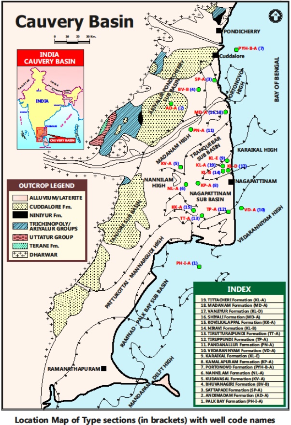
SUBSURFACE: The type section is located at exploratory well Karaikal-B (depth interval: 1355-820 m), in the Nagapattinam subbasin. The hypostratotype is in the well Narimanam-A (depth interval: 1625-105 m). It was named after the Niravi village by ONGC team guided by Venkatarengan et al.(1993) and distributed as Document-VII by KDMIPE, ONGC, Dehradun (1993).
[Figure 1: Type-section Map of Subsurface Formations]
Lithology and Thickness
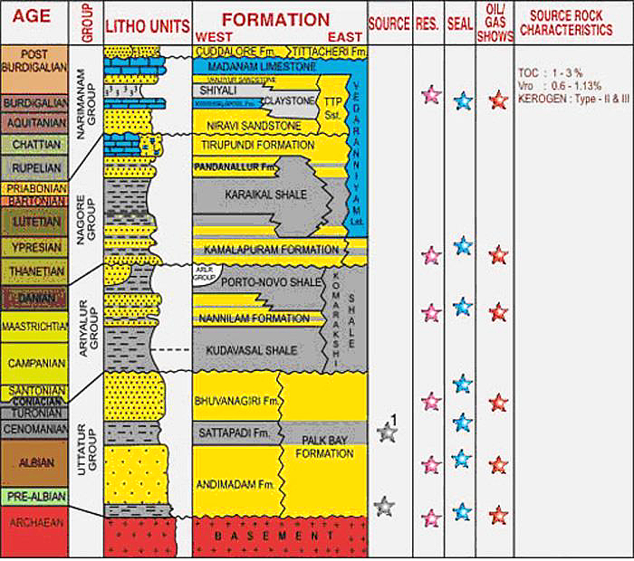
Sandstone. It is predominantly sandstone. It is gray, moderately hard, fine to medium grained, subangular to subrounded, poorly sorted and calcareous, fragments of garnet and pyrite are present. Faint cross bedding features are seen at places. Shale is gray, moderately hard, feebly calcareous, with occasional specks of pyrite, carbonaceous matter and aragonite. Its thickness varies from 535-1520 m. Part of Narimanam Gr.
[Figure 2: Generalized Stratigraphy and Petroleum System of Cauvery Basin (from dghindia.gov.in)]
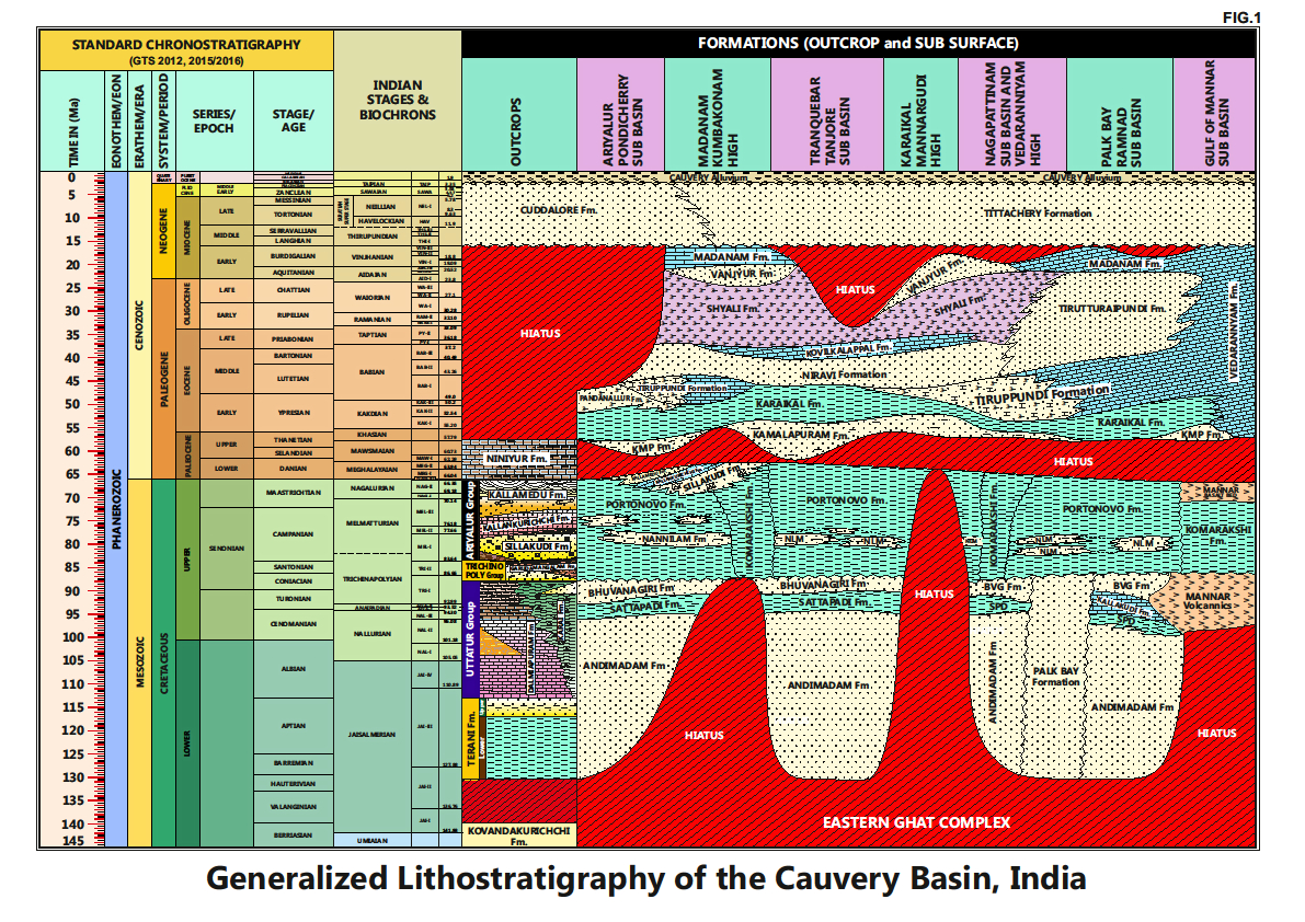
[Figure 3: Generalized Stratigraphy of Cauvery Basin (Provided by A. Nallapa Reddy & R. Nagendra)]
Relationships and Distribution
Lower contact
Unconformable with the Tirupundi Fm / Karaikal Fm / Pandanallur Fm.
Upper contact
Conformable with the Shiyali Fm / Kovilkalappal Fm.
Regional extent
This formation is confined to eastern part of the Ariyalur-Pondicherry, Tranquebar, and western part of Nagapattinam subbasins with southern flank of Karaikal Ridge as the main depocenter.
GeoJSON
Fossils
Diagnostic foraminifera: Globigerina angulisuturalis, G. binaensis, G. gortanii, G. ampliapertura, G. tripartita, Globorotalia opima and costate Uvigerina, Hoeglundina, Sphaeroidina, Gyroidina, Planulina.
Age
Depositional setting
Outer neritic-Upper bathyal.
Additional Information
This unit was first proposed by Rao et al. (1971) as Niravi Sandstone. consisting of predominantly sandstone with intermittent shale bands. Later, Venkatarengan et al. (1993) renamed it as Niravi Formation.


